top of page


About Us
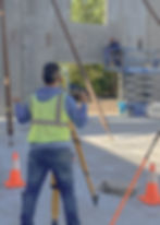
At Terra Surveying, we’re all about accuracy, efficiency, and helping your project move forward with confidence. From boundary and topographic surveys to tree mapping, as-builts, elevation certificates, construction layouts, and aerial surveys, we deliver clear, reliable data you can build on.
Our team uses the latest technology and real-world experience to make every measurement count. At Terra Surveying, we keep things precise, practical, and professional — so you can focus on bringing your vision to life.


Boundary Surveying

Services
Topographic Surveying

Construction Surveying

Aerial Surveying

bottom of page